top of page


LiDAR Laser Scanning
Drone Aerial Photography


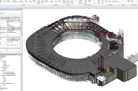
LiDAR Laser Scanning has proven to be the most effective and efficient approach to capturing existing building conditions.
I utilize the latest greatest technology, primarily the Faro S70, S120, Trimble TX5 and Leica BLK360 Laser Scanners coupled with Autodesk ReCap Pro, ReCap 360 Online and Leica Cyclone.
Additionally, I utilize a DJI Mavic 2 Pro and GoPro Karma drone for overhead aerial photography and photo to Point Cloud technology (see video below). I hold an FAA Part 107 Certification.
Point Cloud files can be used for multiple applications such as, modeling existing condition, and appending to Navisworks BIM files for trade coordination purposes.
Please call or email to receive a competitive quote to have your project scanned.


Real Estate Drone Photography - Sample
bottom of page